Gunung Liang. The path less explored


“Of all the paths you take in life, make sure a few of them are dirt.” John Muir

 When a fellow hiker contacted me and asked if I would like to join them to hike Gunung Liang I immediately said yes, not knowing anything about this forest. But I always believe no matter how difficult or easy a hike can be, the challenge is to attempt it. While planning for the trip we faced a few hinders, our climbing dates had to be postponed, two friends from the group who wanted to do a recce of the trail were unable to continue, and had to turn back. Till the last minute I was not sure of the transportation. I even told a friend that it looks like the “universe is giving me a message” 

IMG_5639

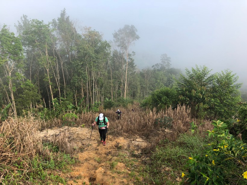
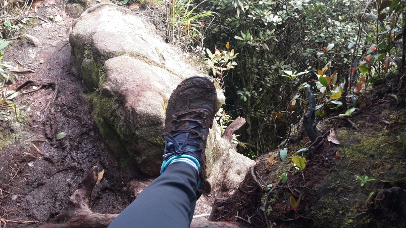
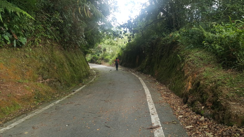
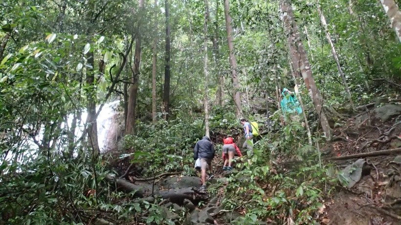
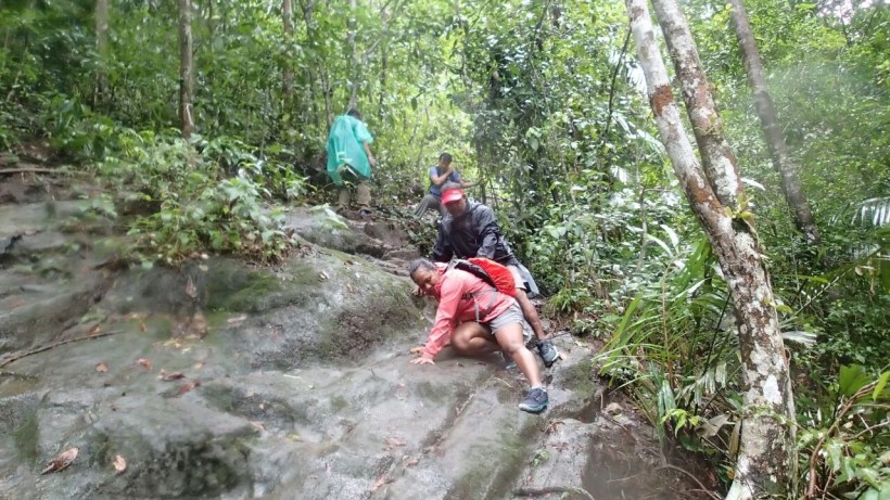
Mt. Liang (West and East) is 1933 m above sea level and this twin peak is ranked 35th on the list of the mountains of Malaysia. It is about 440 m higher than Gunung Nuang and about 250 m higher than Gunung Rajah. At 5.30 in the morning with our headlamps we all set into the forest in pitch darkness. The trails were wet from the previous days’ rain and I found myself on all fours at certain areas where it was slippery, holding onto the roots of trees to make sure I didn’t slip or fall into the ravine. 


IMG_5645

Before the hike I did some research on Gunung Liang and leeches and bees are what every writer has warned hikers about. Not even 15 minutes into the forest and in the darkness, I started feeling the leeches. It was just all over, after sometime I just didn’t want to think about it. Well, what more could I do?

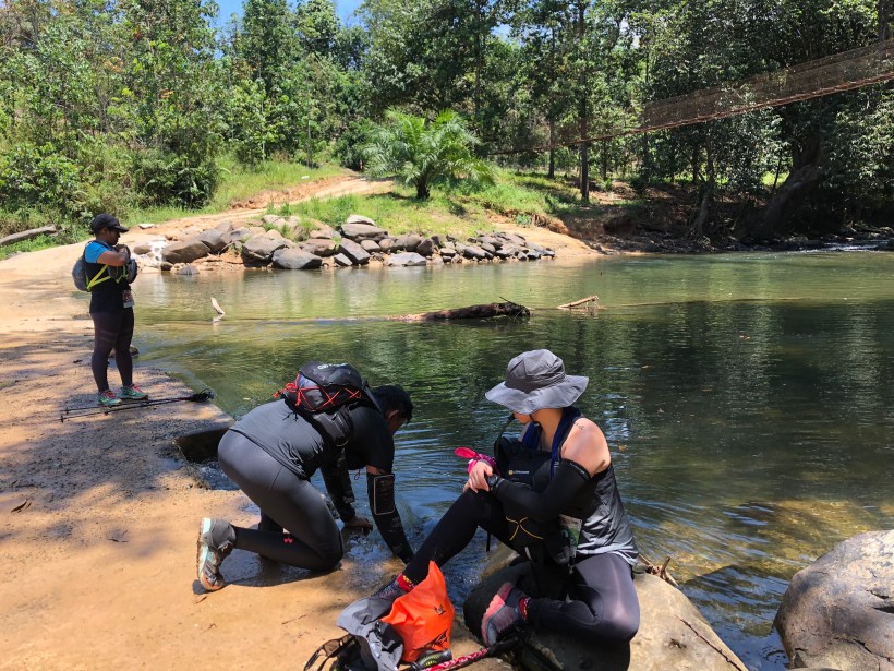
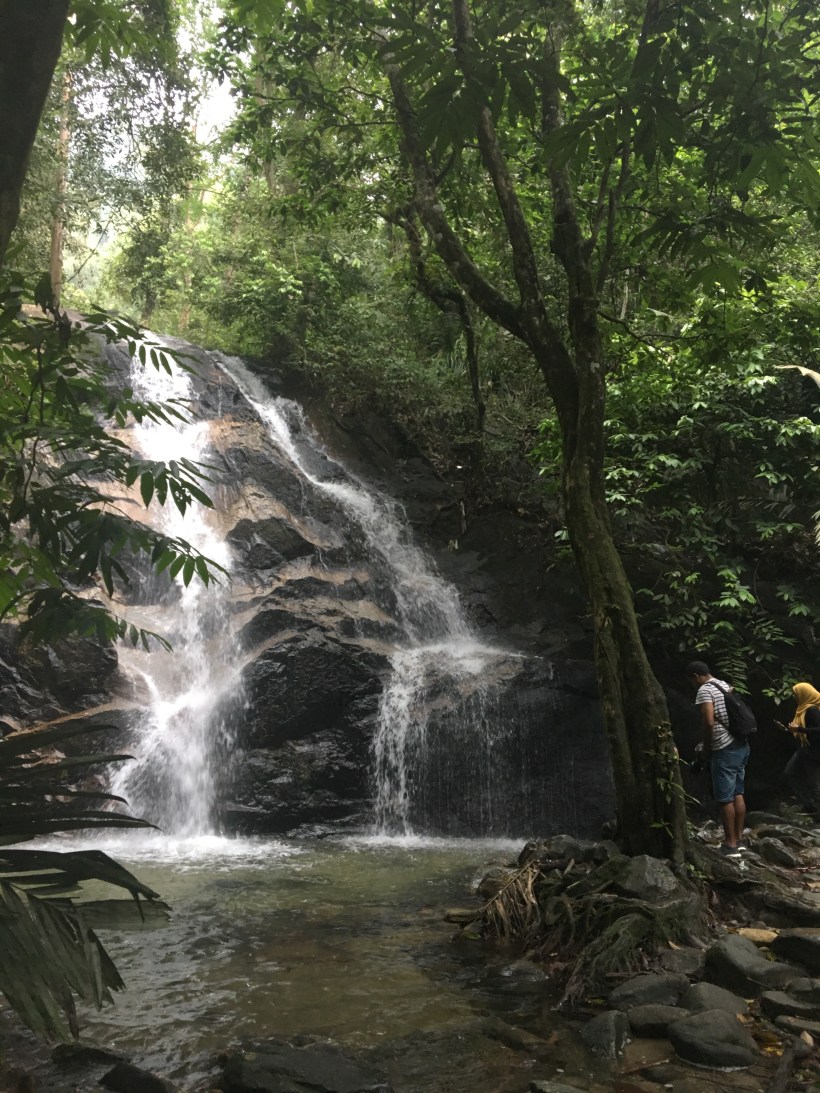
The almost 2 hours walk towards Lubuk Hantu was fairly nice (The name Lubuk Hantu ,allegedly comes from an incident several decades ago in the 1970s or so when some local people saw an apparition of a man dressed in a fine suit on one of the rocks next to the river).We spent some time at the river, cleaning ourselves from the leeches that were feasting on us, had some snacks before facing the real ascent. 

1c59ded4-ca1f-4070-9de5-e1936197c624

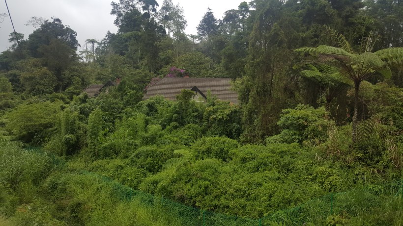
The hike to Kemp 7E was a continued ascent, though we got few places to enjoy the level ground. Kemp 7E looks to be a popular camping spot, but I personally feel Lubuk Hantu would make a nice camping ground with the river close by. The cool breeze at camp 7E gave me the chills, while some were still enjoying the rest, few of us started the hike towards the peak. 

19515eed-0e39-42bd-89f7-22092cd06756

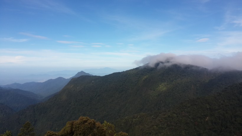
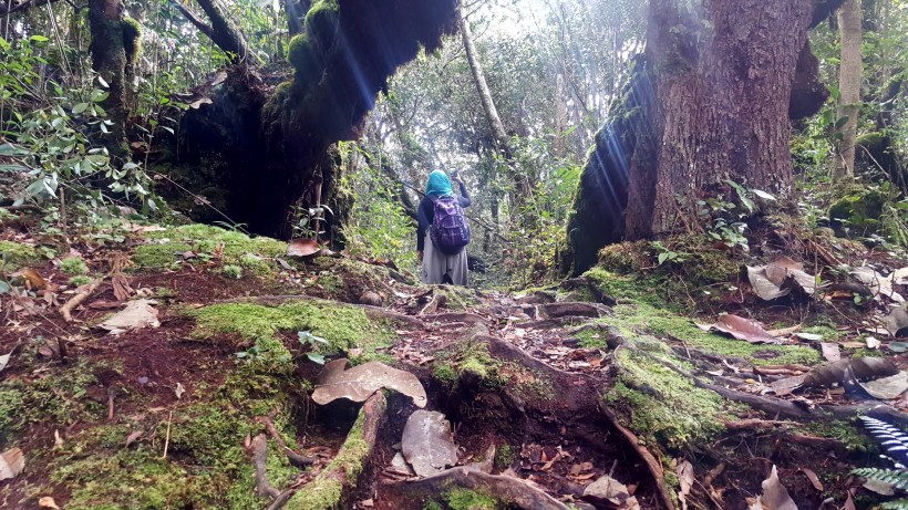
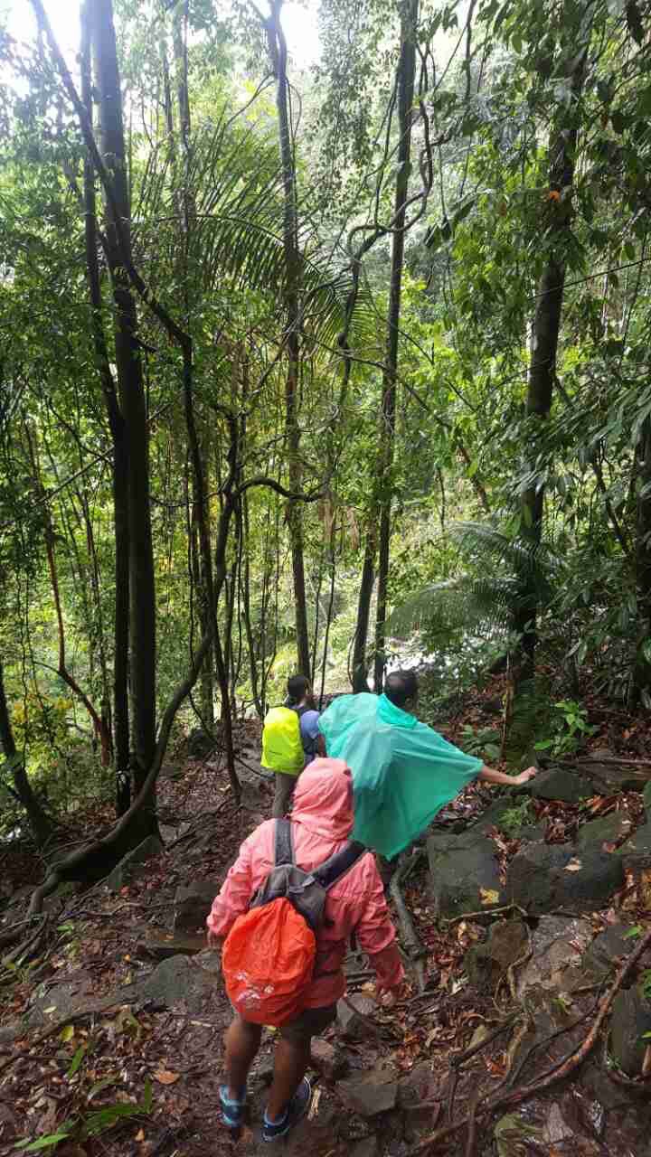
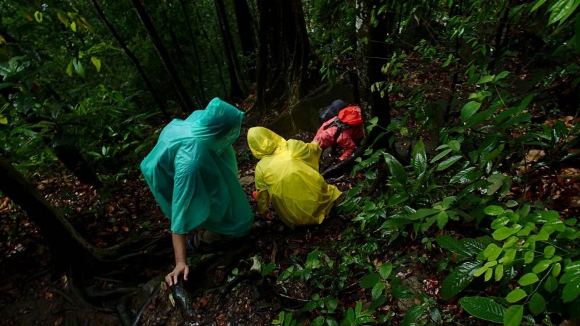
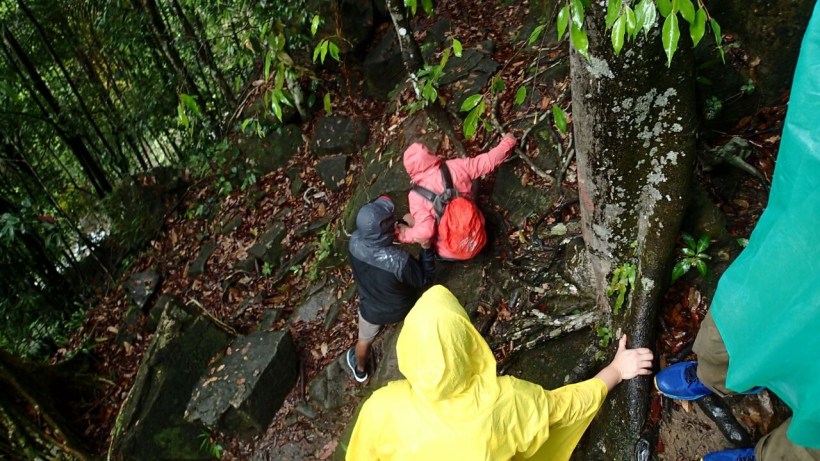
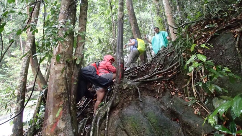
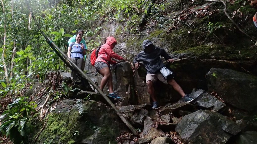
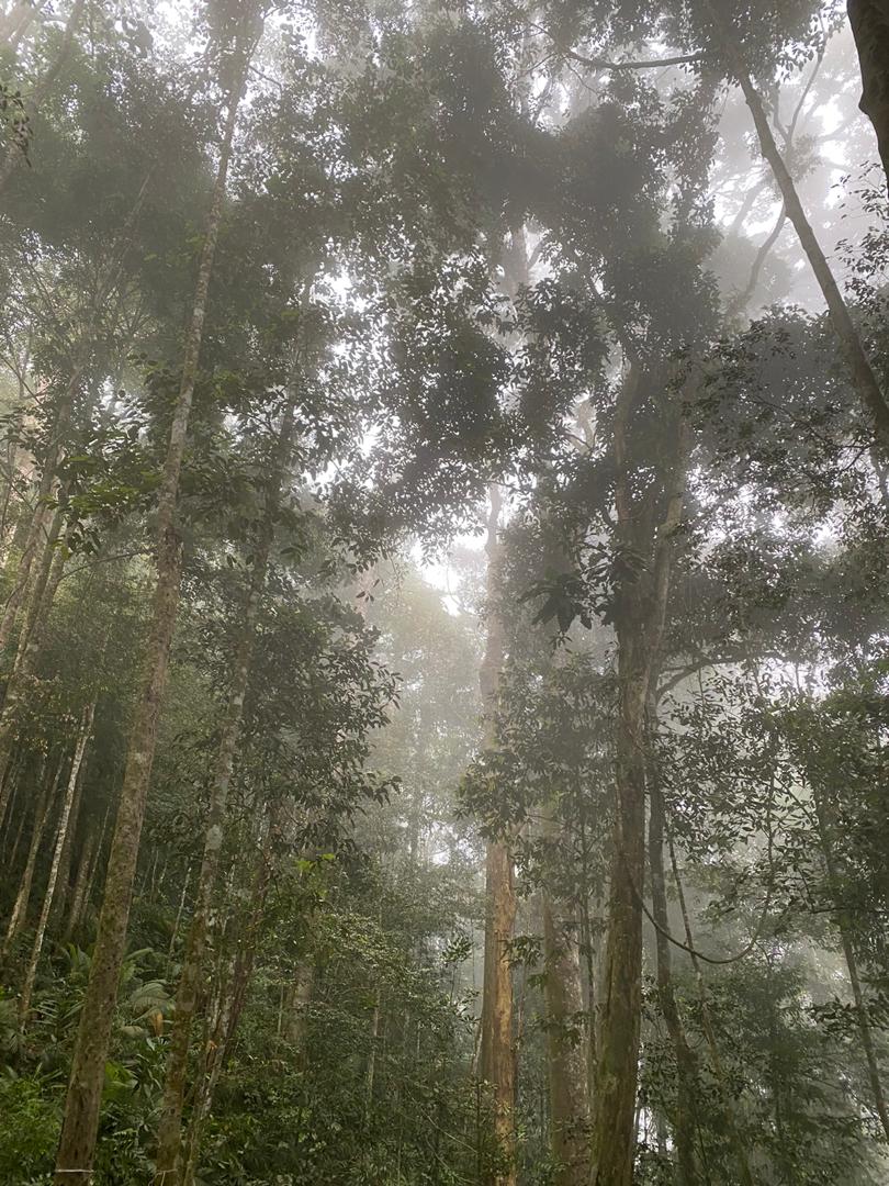
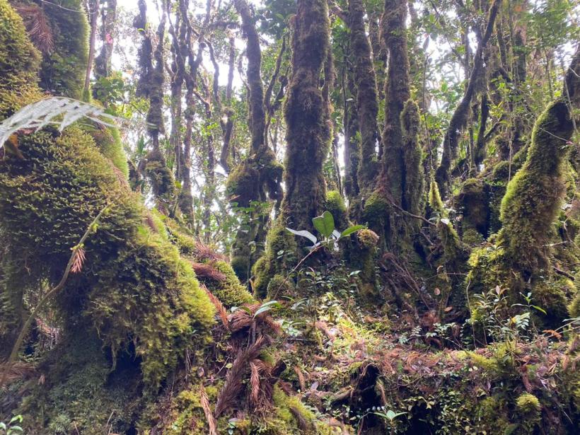
From 7E, the trail remains steep in places, hence we did not get much time to enjoy a breather. It was a continuous climb. We passed some very shapely boulders on the way towards the peak. After sometime on the trail the landscape started to change. Beautiful narrow bamboo alleys with fallen leaves that gave an autumn feel, and then mossy forest. It was one of the most breathtakingly beautiful climbs I have ever been on. It was steep slopes till the peak, and in many areas required both hands to pull oneself up. Hence a good amount of physical fitness is required to go through the challenging climb. At one point I complained to my friend saying there are too many climbs and she said, you came to climb Liang, so now you do it. I needed the hard push, I guess!

e3f015e2-0a67-4813-a31f-b49d4a3fba65

IMG_5654

c265d38b-62b9-4e41-b55b-fd8aca474630

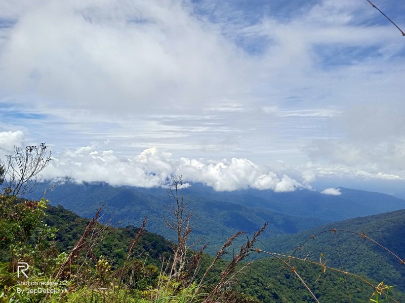
You don’t see much of a view at the peak of Gunung Liang East, with a fallen beirut, on a grassy peak is what you see. As we climbed, I was told there will be two peaks east and west and apparently west is more beautiful. Other than our group there was one other group climbing Liang on that day, and one of them told us it’s just 5 minutes from here. Since I knew that she is a trail runner and a podium finisher, I thought to myself her 5 minutes might be 3 times more for us, but she reassured me that it was just 5 minutes. The walk from Liang East to west included 2 very steep climbs. I got hesitant for a moment seeing it, and even thought of staying back. But one of the hikers said, you came all the way here and why not. True why not? I won’t say it was easy for me, but with the help from another fellow hiker I climbed down. I wasn’t sure, but I was so glad I did it. It was breathtakingly beautiful, you need to be there to see or experience the distinction in landscape. Liang East is a tropical landscape with a collapsed metal pyramid on a grassy path, whereas Liang West is of temperate feel with the mossy forest. Though it does not offer any view, it was pleasant. We spent some time enjoying the mystical forest. 

194d5cab-6a3e-452b-851e-270d657a4aba

76188c5c-3048-494c-99e2-d121f4e26992

When you do long full day hikes, you are always excited when you hike to the peak, but going down always seems to take forever. One thing, you are tired and exhausted and fatigue kicks in. That’s where the mental strength is required. While walking down towards Kemp 7E I said out loud “why am I doing this?” and the hiker behind me said “because you can”. The return was faster at first, but the continuous downhill took its toll on our bodies, and we slowed down.

dbe69dc5-fdc9-443d-8460-6a421aa0091a

Going down to Kemp 7E seems forever. When we reached 7E few from the group were already there. Rather than spending too much time there we decided to keep moving. With the current weather one never knows when it would start to rain and we definitely don’t want to get stuck near the river without being able to cross due to water level. 

IMG_5640

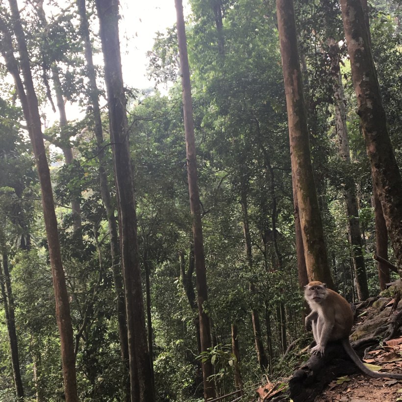
Leaving behind 2 hikers and the sweeper, the rest decided to walk forward since it was going to be dark soon. We knew they were in good hands and one with knee pain, he needs to move slowly. Even though we tried we could not get out of the forest before darkness set in. With headlamps on we set out. The shrill hum of cicada (riang-riang) echoing the forest, the whooping hoot of gibbons, the honk of hornbills, and the various sounds from the creepy crawlies filled up the forest. Hiking Gunung Liang requires strength and endurance especially if it’s a day hike. Long hard incline, tree root, 70 – 80-degree climb, the technical trail and the climbs using core muscle, and pulling yourself up over the huge trees with whatever upper body strength you have, 

f19e66da-5f6b-4026-aea3-8be1d3d43867

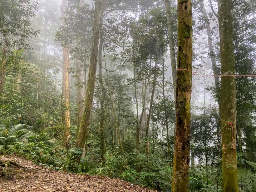
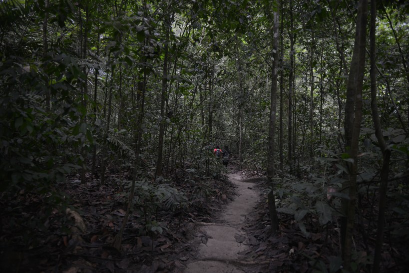
Gunung Liang had an unexplainable vibe. A sense of a calm that keeps reminding you of your presence in that very moment and you feel drawn into the depth of its silence. During weekends Malaysian trails are always crowded, but not this place, other than us it was just another group of 6 people. As we walked the trails, we noticed how untouched the paths were. I don’t know why Liang is not explored as much as other forests, because it was such a beauty. You get everything a hiker could dream for, the steady paths, the incline, the root trails, the mud, the climbs and the mystical mossy forest. 

You have to see it to believe it


It was indeed an ultra experience…


“Even when you have gone as far as you can, and everything hurts, and you are staring at the spectre of self-doubt, you can find a bit more strength deep inside you, if you look closely enough.”
― Hal Higdon

This was exactly how I felt on the 10th of March while embarking on an ultra run around the Kiulu Valley, North of Kota Kinabalu. Borneo Ultra Trail Marathon (BUTM) is an extreme ultra trail marathon. It takes runners through rugged back roads, steep hills and treacherous jungles.

Ultra running gives me a feeling that I don’t get from running half marathons. (I am yet to do a full marathon), the feeling one gets while going up and down the trail, the feeling of getting close to nature, is unexplainable.

With the sound of the bong, I set out at 6.00am in the morning before the sunrise, to challenge myself and to complete BUTM 50K ultra trail with a cut off time of 17 hours.

Screen Shot 2018-02-13 at 2.17.41 PM

During the 1st 6.6km I moved up a muddy hill, looking around and enjoying the scenery, socialising with people around me and hearing their stories; the guy who told me that he attempted TMBT 100K five times but was never able to complete and there he was, yet again doing a 50k, the girl from Brunei who has been coming for the past 3 years and the man from Singapore who was not so happy with his training.

The good thing about ultras is that you can go as slow as a turtle and maintain a good conversation with your fellow runner. Going downhill has always been challenging and specially on a gravel trail. I was concentrating on the trail and was going down slowly but still tripped on a rock and there I lay flat on my face. The couple right in front of me came running and helped me up. The lady cleaned my palm, put a band aid on the cut and made sure that I was completely fine before walking away. It took me few minutes to get myself together and start moving again.

The most challenging part of the day started at W7.  Though it was still early morning, with the scorching hot sun, it felt like midday. I felt like giving up several times between W7 and W8. With my hydration bladder almost empty, I was trying hard to save water until I reached the next water point.

IMG_8090 (1)

IMG_8072

I will forever be grateful to the guy who gave me half of his water bottle though he had mixed red bull in it. It was a lifesaver.

Since I was ahead of my cut off time, I moved slowly saving my energy since I still had a long way to go. I wanted to wash my face, pour water on my head, and at that point I would have given anything for a bottle of cold water. I was looking around for villagers selling water. I met a girl on the trail and was with her throughout the next 10 km. We were both talking about the heat, and she was saying that there should be a stream not too far away. She had done BUTM before and was familiar with the trail. True to her words there was a stream or a river. Whatever it was, I  felt like taking a dip. I dipped my buff in water and put it over my head. I cannot explain the feeling of relief. I spent a few minutes near the stream with Melinda.

IMG_8087

By the time I reached 25km, my body felt hot, my legs were weak and I could feel my heart beating very fast. I felt the textbook symptoms of heatstroke.  I poured water over my body and sat on a chair. There were about 10 people around with shoes removed and I could hear some people talking about wanting to DNF (Did Not Finish). After about 30 minutes Melinda told me to go ahead.

The next 9km was merciless. Going up the steep never-ending hill and coming down the sharp slope, there were many times that I felt I was going to fall face down and roll down the hill. Watching every step of the way, careful not to lose balance and not to fall off the cliff, I moved through the very narrow trail trying to go as fast as I could, making sure not hold the people coming behind. It was such a relief to finally come out into the clearing and get the tag scanned.

It was already 5.30 in the evening and I still had 18km to go. As we set out on the next phase of the trail we had a bit of comfort knowing that the elevation would be less than the previous hills. However,  by that time even the 200m elevation felt like 1000m on our fatigued legs.  As darkness set in, with our head lamps and blinking lights on we set into the jungle. And to make things worse it started pouring. As we entered the narrow trails of the jungle, we could feel the mud sucking on our shoes and the slippery trail slowed us down. We wanted to go fast but we were unable to.  And yet, we put in every effort to move as fast as we could in the complete darkness;  the only light we had at this point was from our fellow runners and from our own head lamps.

IMG_8092

The last 18km felt like never-ending; a forever trail. We crossed a number of bridges, went past small villages onto a main road, and were back in the deep jungle. There were times we felt as if someone was calling out; the different sounds from the jungle, I would look behind to see if anyone was coming, only to see pitch black darkness. We went on and on and on…

When my friend called out and said, ‘Aunty come fast, we are almost at the finish line,’ I shouted back, ‘How do you know?  Can you see any light?’  And then I started hearing the music and the voice of the presenter; it seemed to be coming from near but it felt so far.

As I approached the last station, the girl scanned and cut off my tag, and said, ‘Congratulations, you made it.’  I felt so relieved. My legs were shaking and the girl told me take a seat and rest a bit. I shook my head and crossed over the bridge to the finish line.

My friend was there, and at that very moment I didn’t know what I was feeling, just glad that we did this together.

IMG_8095

As I sat down on the bench next to my friend, I could feel the burn from the chafed skin, the pain on my palm and knees from the fall.  We were both hungry and tired but we were talking about signing up for the next ultra.

Tea in the green.

The journey to Cameron highland started on a bus from Kuala Lumpur, and took roughly 5 hours. The weather was nice, 15degrees and all clad up in jackets and hoodies, we didn’t rush to the apartment, but to have a nice hot meal.

The apartment we rented was a bit further away from the town, up on a little hill. As we reached the building we could see that it was a developing area, since we saw construction and the roads looked very new too.

20170127_162726.jpg

20170128_181800.jpg

20170128_185442.jpg

Cameron Highlands is the most extensive hill station in Malaysia. It’s beautiful and very green, making you feel very close to nature when walking around the city.

https://en.wikipedia.org/wiki/Cameron_Highlands_District

One should never miss the tea plantation when in Cameron Highlands. As you drive around you see the scenic views of green on green, spreading as far as your eyes can see. One of the main tea plantations are by BOH plantations, which is the leading tea grower in Malaysia and 95% of the tea produced in Cameron is used in Malaysia.

16357279_1856364851308563_471468729_o.jpg

From the tea plantation we went up to the highest point of Binchang. If it had been upto me I would have walked up even if took a few hours. But the teenagers seemed a bit reluctant to do it so we drove all the way up the winding narrow roads to the top, and climbed up the tower. It was cold and windy but what a site it was…

20170128_100017.jpg

20170128_095957.jpg20170128_100007.jpg

The mossy forest is another popular site in Cameron highlands. The unique amazing moss covered forest is located at the Batu Gangan Forest Reserve of Cameron Highlands, 2031 meters (6,700 feet) above sea level.

20170128_103303.jpg

The pictures do not do justice to what you actually see. It looks mystical. Like a scene from one of these Lord of the Rings movies.

20170128_103152.jpg

No wonder the kids didn’t want to get their Vans and Converse dirty.

20170128_103921.jpg

I knew Cameron had a lots of trails and due to the rainy seasons some of these trails are closed to public for safety reasons. I asked a tour guide which trails would be open and he told us that trails 2 and 3 were open. Though we were new to the place, with the help  of a map and Google Maps we identified the entrance to trail 3.

It started from a main road, and as we walked up it looked like a narrow winding street up, with no sign of a forest. But we walked up and at the top we found a beautiful house surrounded by a garden.

And right in front of the house there was a sign saying “Forest walk 3”. It was a very narrow entrance but we kept on. The cool breeze, the sound of nature, and the rays from the sun, it was just… amazing…

We walked for about 2 hours into the forest and we started seeing signs that lead to route 2 as well. But we were not very sure as to where it would lead, so we decided to turn back.

20170129_120254.jpg
Photo credit: Marie

20170129_113024.jpg

C360_2017-01-29-10-58-36-606.jpg
photo credit: Marie

On the way back I saw this house which was actually quite further away… but imagine living in this house surrounded by all things green…

20170127_163407.jpg

I was really glad that we took an apartment away from the city, because we got to explore the surrounding area on foot. While walking we came across this beautiful little street; with a hotel and a restaurant and it looked like a page out of a story book.

The trails, the forest of Cameron Highlands and even the streets, gives you a very different feeling…a feeling I can’t explain.

But one thing I know for sure is that I would come back again to hike up Gununung Birchang. It’s something I know I should do.

Come join me..

This slideshow requires JavaScript.

Where Waterfalls Begin…

Kanching rainforest waterfall is about a 30min drive from KL center on a traffic free weekend morning. My kids, the not so active girls agreed on doing this hike, which  was quiet surprising and wonderful. Kanching is quite popular for jungle trekking, camping, swimming and barbecuing. Being the weekend we saw a packed pool at the first level. From level 1 to level 4 it’s an easy walk up with concrete steps, except for a few places where the earth had created it’s own steps.

FAI_6383.JPG

IMG_1960.jpg

The previous night, I had looked up Kanching waterfall and came across mentions of aggressive monkeys in a few articles. But I assumed unless we bothered them they wouldn’t bother us. We did see a few monkeys having a good time stealing food from the picnickers, while they had a nice dip in the cold water. The monkeys were having there own party.

IMG_1824.jpg

Though Kanching waterfall has 7 levels, most visitors don’t go beyond level five, but we (being the adventurers we were) decided to go up to the 7th level and kept on moving.

IMG_1786.jpgFAI_6357.jpg

I have always wondered where waterfalls begin, from where do all that water come from and how would it be? Is it a big river, or a narrow stream?

Once we reached level six I tried to convince my girls to go up, but, it did look challenging and I wasn’t able to convince them to climb to the next level. Sadly I had to leave without reaching the summit.

From Kanching we detoured to the Batu caves to climb the 272 steps to enter the 400 million years old caves. Surrounded by monkeys we walked up the steps into the caves to witness a lot of ongoing construction work.

FAI_6387.jpg

FAI_6393.jpg

FAI_6413.jpg

FAI_6411.jpg

FAI_6398.jpg

FAI_6402.jpg

It didn’t feel complete as I had not climbed up to the summit of Kanching waterfall. My good old Malaysian friend Radzi suggested that we go back again.

A week later we were back at Kanching waterfall forest.

As we left home it started to rain so we went prepared with raincoats.

The route felt familiar, already traced. The challenge began at level 6. Clad in our raincoats we kept on climbing. The rocks were slippery and steep. It might not have been the wisest thing to do to on a rainy day, but we had already started. So, we kept on moving up.

IMG_2093.jpg

IMG_1962.jpg

After nearly 30 min from level 7, we reached the top, finally! It was a very narrow stream with a little pool of water.

IMG_1956.jpg

I knew the hardest part would be the climb down. The rain made the already steep trail more challenging.

IMG_2084 (1).jpg

IMG_2089.jpg

The proverb “look before you leap” made a lot of sense on that day. Before letting go of one foot I had to identify a rock where I would place my other foot. I had to check the roots and branches if they were strong enough to hold my weight.

IMG_2085.jpg

IMG_2063.jpg

IMG_2077.jpg

It was not easy, and again, doing this on a rainy day was definitely not the smartest thing to do. But it was all worth the experience. As my dear friend Radzi kept on saying; “it was fun”.

Life is about challenges, facing them and overcoming them.

Interested to trace my trail…

This slideshow requires JavaScript.